SURVEY & CADD
- Home
- Services
- SURVEY & CADD
Services
Total Station Survey
A total station survey is a vital tool in the field of civil engineering, combining the functions of a theodolite for measuring angles and an electronic distance meter (EDM) for measuring distances.
Here’s a breakdown of what a total station survey involves and why it’s important:
What is a Total Station Survey?A total station survey uses a total station, which is an electronic/optical instrument, to measure both horizontal and vertical angles as well as distances. This information is then used to create precise maps, plans, and models of construction sites and land areas.
Key Features of Total Station Surveys:
1. Angle Measurement
2. Distance Measurement:
3. Data Collection
4. Integration with GPS
- Angle Measurement:
- Measures both horizontal and vertical angles with high precision.
- Distance Measurement:
- Uses EDM technology to measure distances accurately over long ranges.
- Data Collection:
- Stores collected data electronically, which can be transferred to computer software for further processing and analysis.
- Integration with GPS:
- Can be used in conjunction with GPS for enhanced accuracy and positioning.
- Topographic Surveys:
- Creating detailed maps of the terrain, showing features such as hills, valleys, and water bodies.
- Construction Layout:
- Setting out positions for construction elements such as buildings, roads, and bridges.
- Land Surveying:
- Measuring property boundaries and creating legal descriptions for land parcels.
- Infrastructure Projects:
- Surveying for the design and construction of infrastructure projects like highways, railways, and pipelines.
- Monitoring and Maintenance:
- Regular surveys to monitor structural integrity and movement over time.
- Accuracy:
- High precision measurements ensure accurate data collection.
- Efficiency:
- Faster data collection compared to traditional surveying methods.
- Versatility:
- Suitable for a wide range of surveying tasks in various terrains and conditions.
- Data Management:
- Electronic data storage and transfer streamline the process of data analysis and mapping.
- Preparation:
- Set up the total station on a tripod over a known reference point (control point).
- Calibrate the instrument to ensure accuracy.
- Data Collection:
- Measure distances and angles to various points on the site.
- Record data points electronically in the total station.
- Data Transfer:
- Transfer the collected data to a computer for processing.
- Use specialized software to convert the data into maps, plans, and models.
- Analysis and Mapping:
- Analyze the data to create detailed topographic maps, site plans, and 3D models.
- Identify any discrepancies or adjustments needed.
Imagine you’re planning to build a new house on a plot of land. A total station survey is like having a highly advanced measuring tool that not only tells you the exact dimensions and slopes of your land but also creates a detailed map showing where every tree, rock, and boundary line is located. This precise information helps you and your construction team plan accurately and build your house in the perfect spot.
A total station survey is an indispensable tool in civil engineering, providing accurate and detailed measurements necessary for planning, designing, and constructing various types of projects. By utilizing advanced technology, total station surveys enhance the precision, efficiency, and overall quality of construction and land surveying tasks.
Services
DGPS
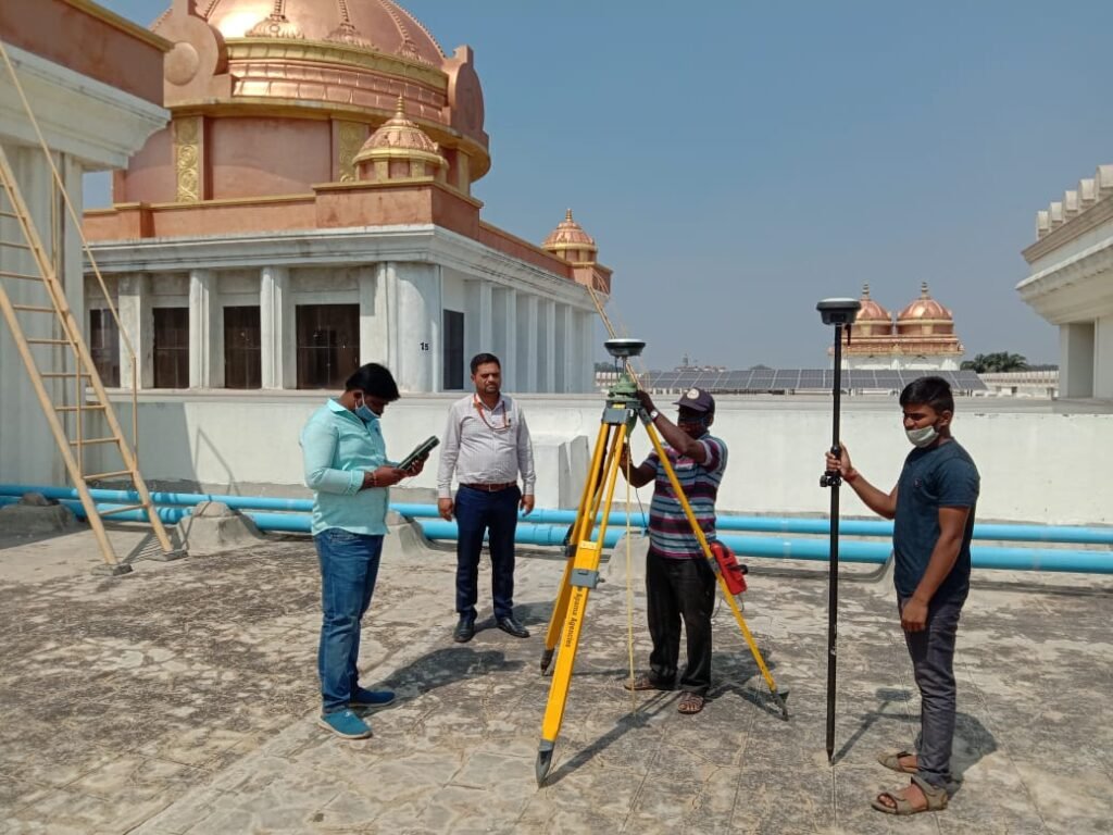
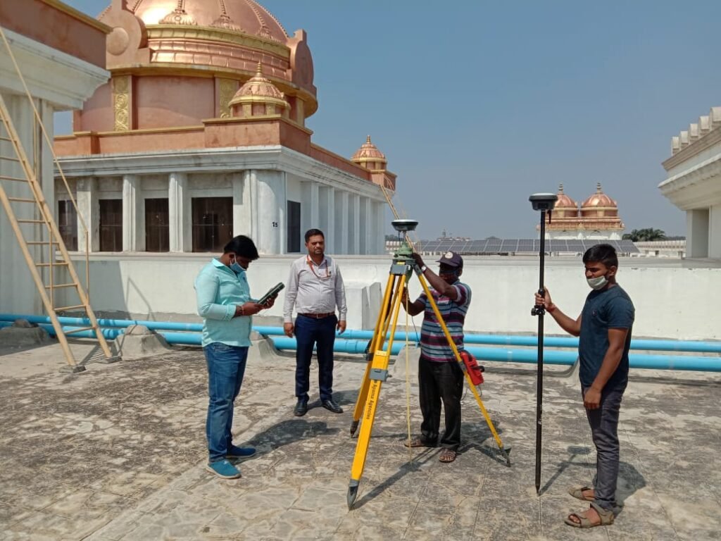
A Differential Global Positioning System (DGPS) survey is an advanced surveying technique that enhances the accuracy of standard GPS measurements.
What is a DGPS Survey?
A DGPS survey uses a network of fixed ground-based reference stations to correct the GPS signals received by a mobile receiver. This correction significantly improves the accuracy of the positioning data, making it suitable for high-precision applications in surveying, mapping, and construction.
Key Features of DGPS Surveys:
1. Enhanced Accuracy:
2. Real-Time Corrections:
3. Base Station and Rover
- Enhanced Accuracy:
- Provides positioning accuracy within a few centimeters to a few meters, compared to the standard GPS accuracy of around 10 meters.
- Real-Time Corrections:
- Delivers real-time corrections to the mobile receiver, improving the accuracy of position measurements instantaneously.
- Base Station and Rover:
- Involves two main components: a fixed base station that collects and broadcasts correction data, and a rover unit that receives GPS signals and the correction data to determine its precise position.
- Set Up Base Station:
- Place the base station at a known, fixed location.
- The base station receives signals from GPS satellites and calculates correction data based on its known position.
- Data Collection by Rover:
- The rover unit, which is a mobile GPS receiver, collects signals from GPS satellites.
- The rover receives real-time correction data from the base station, either directly via radio signals or through a network.
- Real-Time Data Processing:
- The rover processes the correction data to adjust its position calculations, resulting in highly accurate positioning data.
- Survey and Mapping:
- The corrected positions are used to conduct detailed surveys, create accurate maps, and set out positions for construction projects.
- Land Surveying:
- Precise boundary determination, topographic mapping, and cadastral surveys.
- Construction and Engineering:
- Accurate site layout, monitoring of construction progress, and ensuring structures are built to design specifications.
- Agriculture:
- Precision farming techniques such as automated planting, fertilizing, and harvesting.
- Marine and Coastal Surveys:
- Navigational aid for vessels, underwater mapping, and coastal erosion monitoring.
- Environmental Monitoring:
- Tracking changes in landscapes, wildlife habitats, and environmental features.
- High Precision:
- Provides centimeter-level accuracy, essential for detailed and accurate mapping and construction tasks.
- Real-Time Capability:
- Delivers immediate correction data, allowing for real-time decision-making and adjustments.
- Versatility:
- Applicable in various fields including surveying, construction, agriculture, and environmental studies.
- Cost-Effective:
- Reduces the need for repeated measurements and corrections, saving time and resources.
Imagine you’re a farmer using a GPS-guided tractor to plant crops. Standard GPS might place your tractor within 10 meters of its actual position, which isn’t precise enough for planting rows of crops accurately. With DGPS, you get corrections that place your tractor within a few centimeters of its true position, ensuring that each row is perfectly aligned and evenly spaced.
A DGPS survey is an advanced method that significantly enhances the accuracy of traditional GPS, making it invaluable for tasks that require high precision. By using real-time corrections from a base station, DGPS provides reliable and accurate positioning data, supporting a wide range of applications from land surveying to precision agriculture.
Services
DIGITAL SURVEY & INFRASTRUCTURE MAPPING
Empowering clients. CSTPL is a trusted partner to clients throughout the Karnataka. Our experience has touched thousands of acres and hundreds of miles of land where surveying and mapping is a critical step for high-profile transportation and infrastructure projects.
Who We Are
WHY CHOOSE US
Broad Expertise
We see the big picture because of our depth of experience and expertise. This means that we ask the right questions and get to the root cause of client issues. This saves you time and money.
Global Perspective
We have extensive knowledge and experience with a variety of organizations in an array of industries. This gives us a unique perspective of a global marketplace and an appreciation for cultural differences.
Flexible, Innovative and Customized Solutions
We are flexible and innovative problem solvers with a great track record for success. We will generate effective solutions that truly meet your unique business requirements.
Commitment to Positive Results
You can count on us to stay to help you through the execution of our recommendations and be available to coach or train your people to achieve positive outcomes.
Research-Based Methods
We incorporate our research, learning and knowledge of global best practices in our work to ensure effectiveness.
Accreditation + Experience
All of our consultants have accreditation plus experience in their fields of expertise to provide top value.
Hi I'm Niharika. Can I help you?


